Architects: Showcase your next project through Architizer and sign up for our inspirational newsletter.
The multifaceted and interconnected effects of the climate crisis are unfolding on a massive scale that is difficult to comprehend, let alone visualize. For this reason, Google is now harnessing the power of satellite imagery to offer a crucial and compelling new perspective on planetary change.
When Google Earth was first launched back in 2011, the geobrowser created a 3D replica of our world and, in so doing, revolutionized our sense of planetary scale. It allowed us to travel around the globe, visiting different areas from a bird’s eye view — almost in real-time. Over the past decade, the platform expanded its reach to the furthest and most remote locations on the planet. Now, just in time for Earth Day 2021, Google offers a major update to the service by bringing time travel into the fold. In total, more than 24 million satellite images have been combined to create zoomable 3D timelapse videos of our globe. This technology allows users to explore and observe how the planet has transformed since 1984. 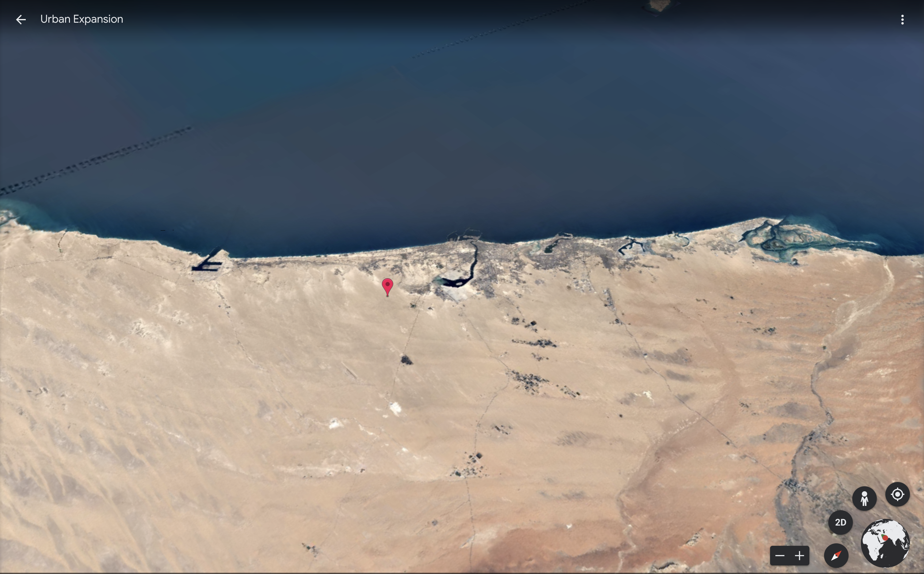
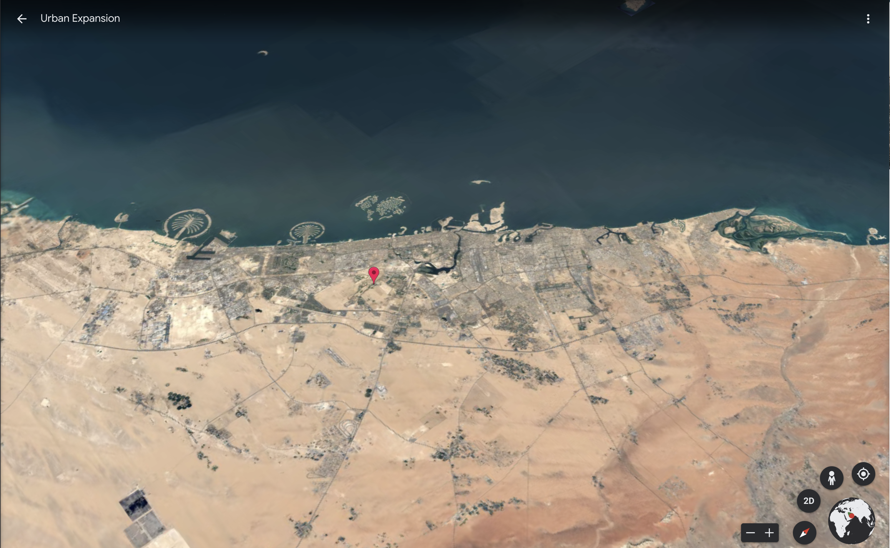
Palm Islands: Dubai, United Arab Emirates. Above: Dubai, 1984. Below: Dubai, 2020. Screenshots from Google Earth Stories: Urban Expansion.
To better contextualize the reasons behind the changing landscape, Google partnered with the CREATE Lab at Carnegie Melon University. The hope is that these new ways of cartographically visualizing data will illustrate climate change in action. To this end, guided tours of select locations narrate how and why various landscapes have changed. Curated collections include “Changing Forests,” “Sources of Energy,” and “Fragile Beauty,” among others. The “Urban Expansion” collection may be of particular interest to architects and urbanists, which allows users to watch water supplies shrink and surrounding ecosystems dull as various cities grow. Not all of the images are doom and gloom; timelapses of Paris, Singapore and Seoul offer inspiring images of greening or densification.
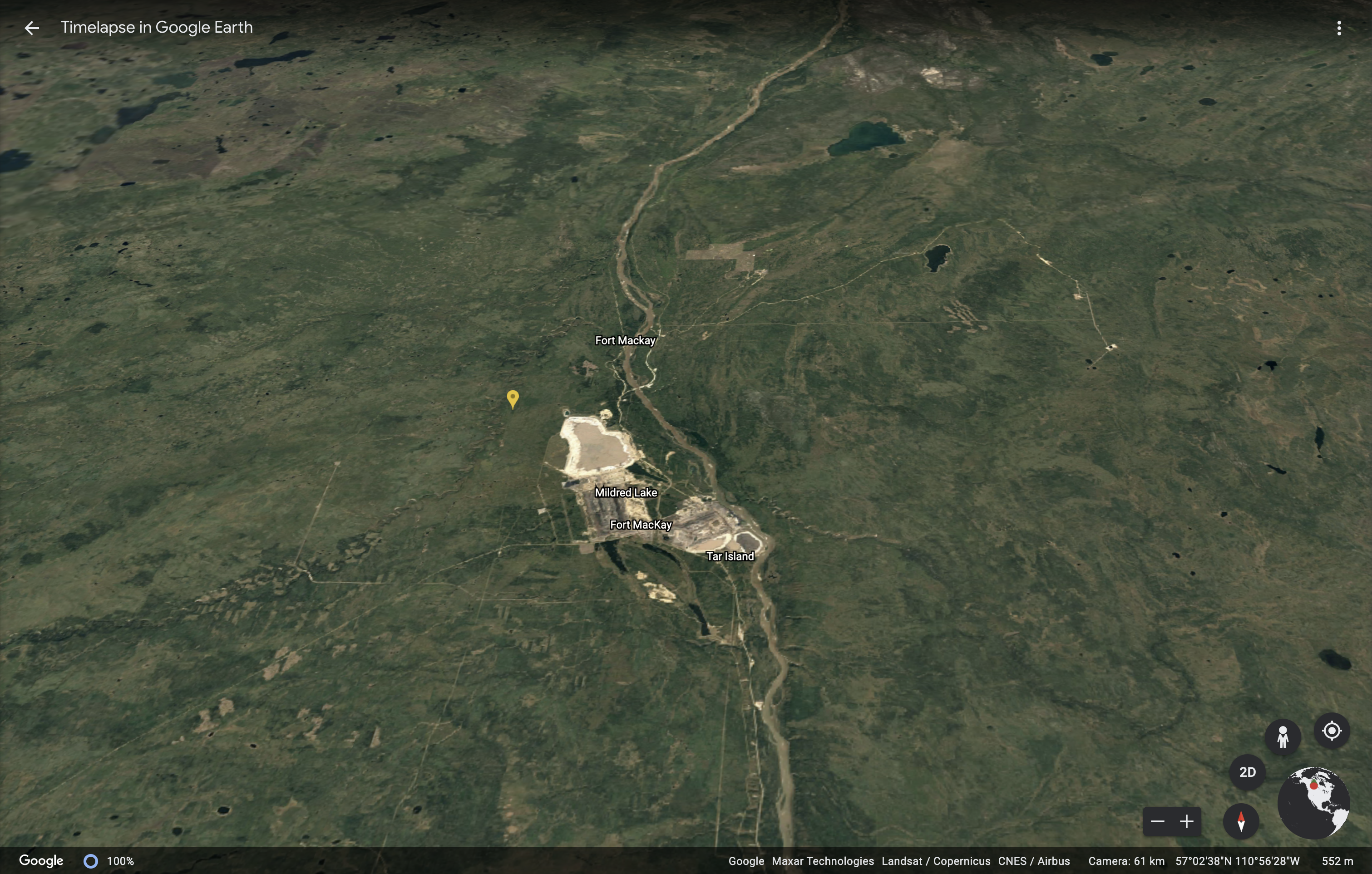
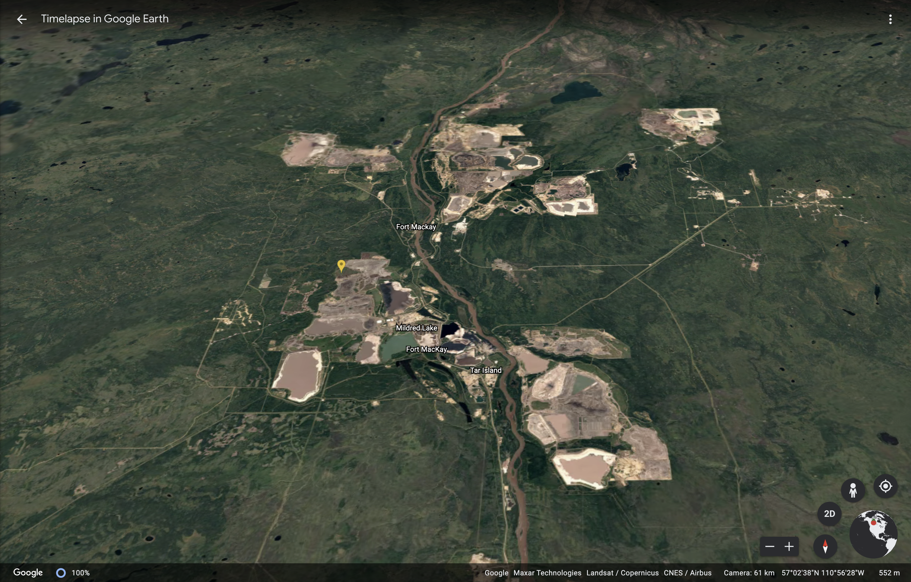
Above: Fort McMurray, Alberta, Canada, 1984. Below: Fort McMurray, 2020. Screenshots from Google Earth Featured Location: Infrastructure
In addition to these narrated stories, “Featured Locations,” whose stunning visuals stand alone without detailed captions, are collected under names such as “Agriculture,” “Megacities,” “Infrastructure,” “Mining,” and “Natural Disasters.” Still, users aren’t limited to Google’s curated collections — by using the search bar, anyone can navigate their time travel around the globe, observing dams flooding African plains, road networks expanding throughout the Amazon rainforest, or glaciers retreating in Greenland. These mesmerizing visualizations of the Anthropocene era illustrate how human society has changed the natural environment, how cities are growing, and the inimitable beauty of our shared ecosystems.
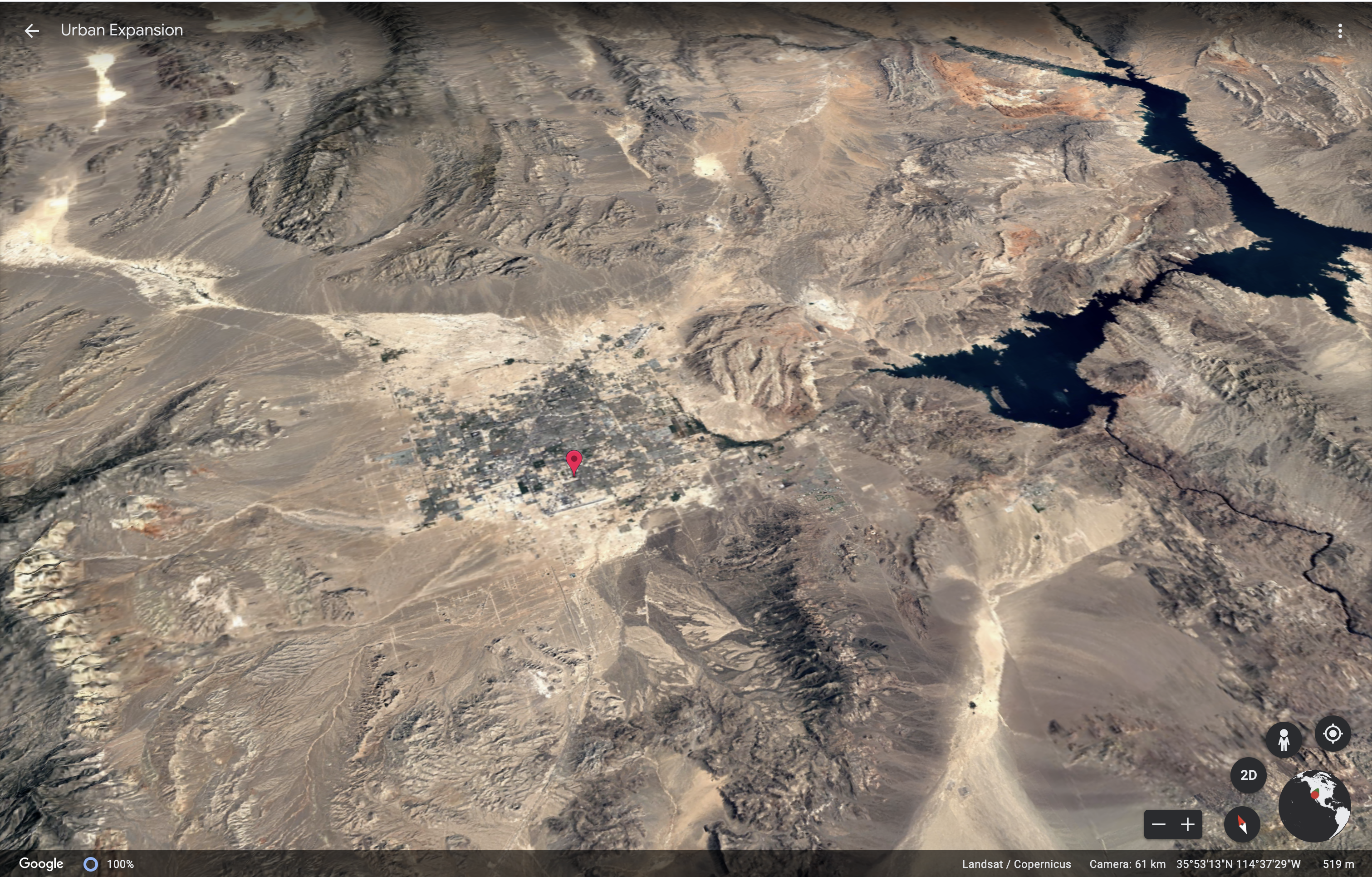
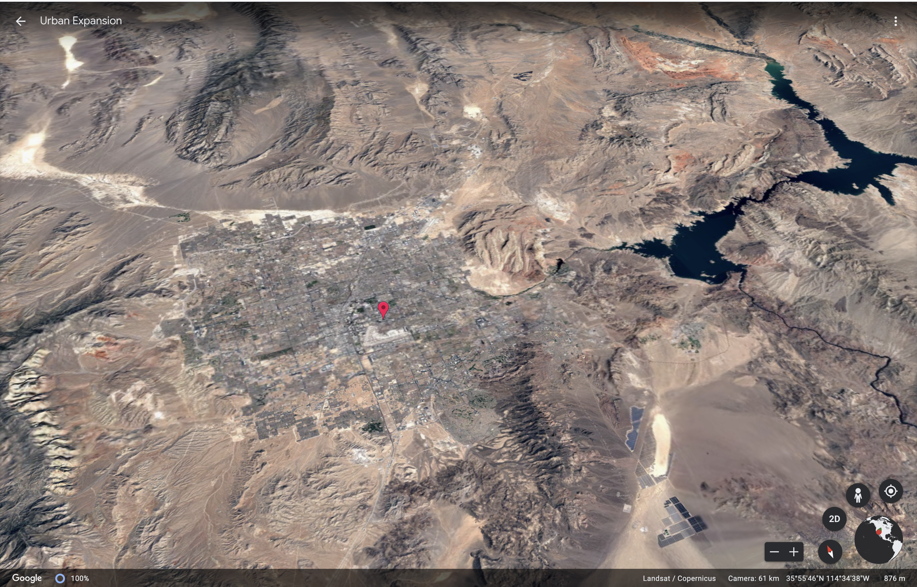
Betting on Growth: Las Vegas, Nevada. Above: Las Vegas, 1884. Below: Las Vegas, 2020. Screenshots from Google Earth Stories: Urban Expansion.
Architects: Showcase your next project through Architizer and sign up for our inspirational newsletter.
The post Watch the Dramatic Evolution of Cities Unfold Using Google Earth’s New ‘Time Travel’ Feature appeared first on Journal.